
Theun Hinboun Power Company Vientiane, Lao PDR
From 2011 – To 2012
Model and report submitted in 2012

President and Senior Consultant
pmcraig@dsi.llc

Chief Engineer
ntlam@dsi.llc

Hydrologist
bmhoa@dsi.llc
The Nam Gnouang (NG) Dam, Bolikhamxai Province, Laos, is built on a major tributary of the Nam Theun/Kading river system, and located approximately 27 km upstream from the first Theun-Hinboun (TH) Diversion Dam, and 9 km upstream of the confluence. The reservoir behind the dam extends approximately 40 km upstream, and covers 105 square km at full storage. The dam is operated by the Theun-Hinboun Power Company (THPC). DSI performed a hydraulic analysis for failure on the NG Dam as part of the Theun-Hinboun Expansion Project (THXP) of the THPC
NG Dam failure analysis was required to support the preparation of the Emergency Response Plan (ERP). The ERP helps facilitate the management of floods that are caused or exacerbated by the dam due to either dam operations or dam failure, and to reduce the risk to lives and property from the consequences of dam failure.
Phase 1 of the study was a preliminary assessment for NG Dam failure scenarios using the HEC-RAS model of the TH Reservoir. Based on the results of Phase 1, additional works were recommended for Phase 2 of the study, including further data collection and an extension of the HEC-RAS model to avoid the downstream boundary effect and properly represent the floodplain. Following the recommendations from Phase 1, the HEC-RAS model was revised and used for the analysis of the NG Dam failure scenarios.
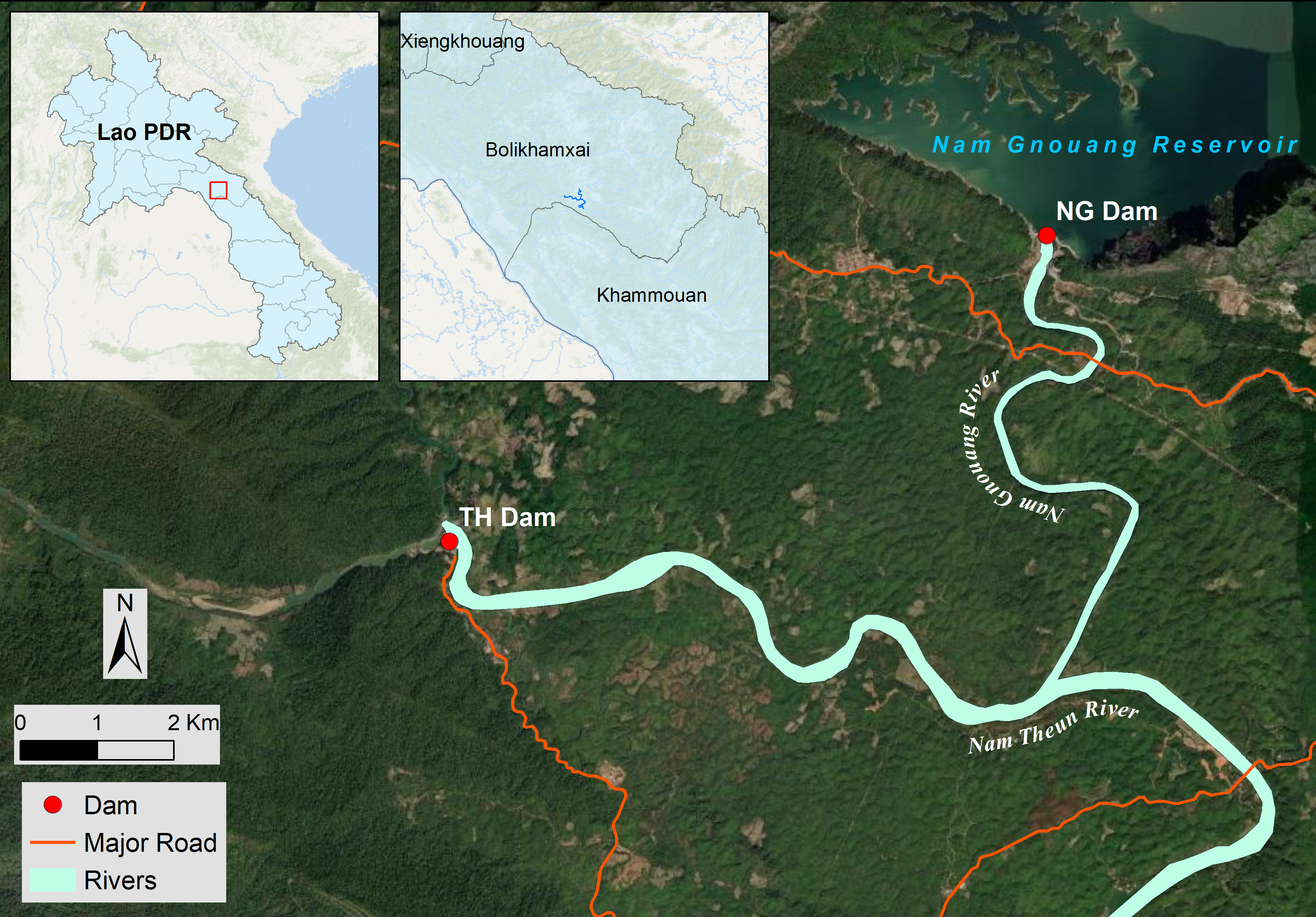
Nam Gnouang (NG) Dam in Bolikhamxai Province, Lao PDR
DSI conducted hydraulic analysis and developed inundation maps for a range of scenarios. Inundation levels and areal extents were needed to support the assessment, which followed the USA Federal Emergency Management Agency (FEMA) dam failure guidance. Based on the results of the analysis, a series of flooding maps were prepared for ERP.
DSI submitted the final model and report to the client in 2012.