
Coastline Engineering
From 2008 – To 2012
Completed and results of this assessment were incorporated into the Final EIS.

President and Senior Consultant
pmcraig@dsi.llc

Water Resources Engineer
kescandrett@dsi.llc
The Kotzebue Sound located on the North end of Alaska, receives freshwater inflow from a drainage area of approximately 41,000 mi2 (106,000 km2), with the major rivers including Noatak River, Kobuk River, and Selawik River. The Kotzebue Ralph Wien Memorial Airport (OTZ) located near the coast is a vital air traffic link for the local area. The airport has a single runway that is aligned nearly perpendicular to the shoreline. OTZ has been the subject of considerable study over the past several years, including the idea of relocating the airport. The final airport relocation feasibility study, released in 2008, concluded that relocation was not feasible due to funding constraints. Subsequently, the Alaska Department of Transportation & Public Facilities moved forward with expanding the Runway Safety Areas (RSAs), conducting a practicability study in 2010. In 2012, the final environmental assessment (EA) for expanding the RSAs was approved, and construction began in 2013.
The main objectives of the study were to determine the existing hydraulic and hydrodynamic conditions for the coastal and nearshore areas around the airport, including the existing coastal circulation patterns and sediment transport, and evaluate the impacts to these processes due to runway extension.
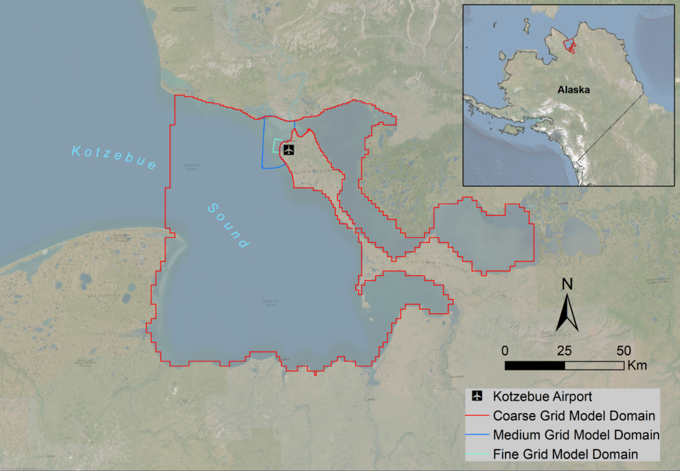
Model Domain for Kotzebue Airport Study
DSI developed three Environmental Fluid Dynamics Code (EFDC) hydrodynamic models for the model domain. A coarse grid model was developed covering most of the Kotzebue Sound, Hotham Inlet, and Selawik Lake. This model was used to determine the boundary condition required for the medium grid model (MGM). The MGM was then nested into the coarse grid model. This model was calibrated to the measured water surface elevations and discharge data from two ADCPs that were collected over a four-month period in 2008. The fine grid scale model (FGM) was nested into the MGM. The FGM was designed to provide the necessary grid resolution in the vicinity of the Kotzebue Airport. This allowed a detailed assessment of the hydrodynamics around the various runway extension options including examination of shear stress and sediment erosion processes. A comparison of the various options was provided to support the selection process.
DSI submitted the final model and the modeling results to the client to support the EA development process.The EA was approved, and construction began in 2013.