
Confidential
From 2018 – Ongoing
The final modeling report was submitted to the clients to support remedial design.

President and Senior Consultant
pmcraig@dsi.llc

Operations Manager
tmathis@dsi.llc

Hydraulic Engineer
jfrjung@dsi.llc

Hydrologist
bmhoa@dsi.llc
The Willamette River originates in the Cascade Mountain Range, flowing through northwestern Oregon for 187 miles to its confluence with the Columbia River. The final 26.5-mile stretch of river downstream of Willamette Falls before the Columbia River confluence is considered the Lower Willamette River. It is a slow-moving, tidally influenced segment that experiences intermittent reverse flow at high tide during the low flow season (usually summer and early fall). Portland Harbor is defined as the 9.9-mile dredged reach of the Lower Willamette River between River Miles 1.9 and 11.8. The harbor is surrounded by light and heavy industry and mixed commercial and residential development around the City of Portland. A variety of industrial activities historically occurred and continue to take place around the harbor, including marine shipping terminals, bulk fuel facilities, manufacturing, and other commercial operations. In 2000, USEPA placed the Portland Harbor Superfund site on a National Priorities list (NPL).
The project goal was to develop a scientifically defensible model to simulate the hydrodynamic and sediment transport processes in Portland Harbor to support contaminate source identification and cleanup cost allocation.
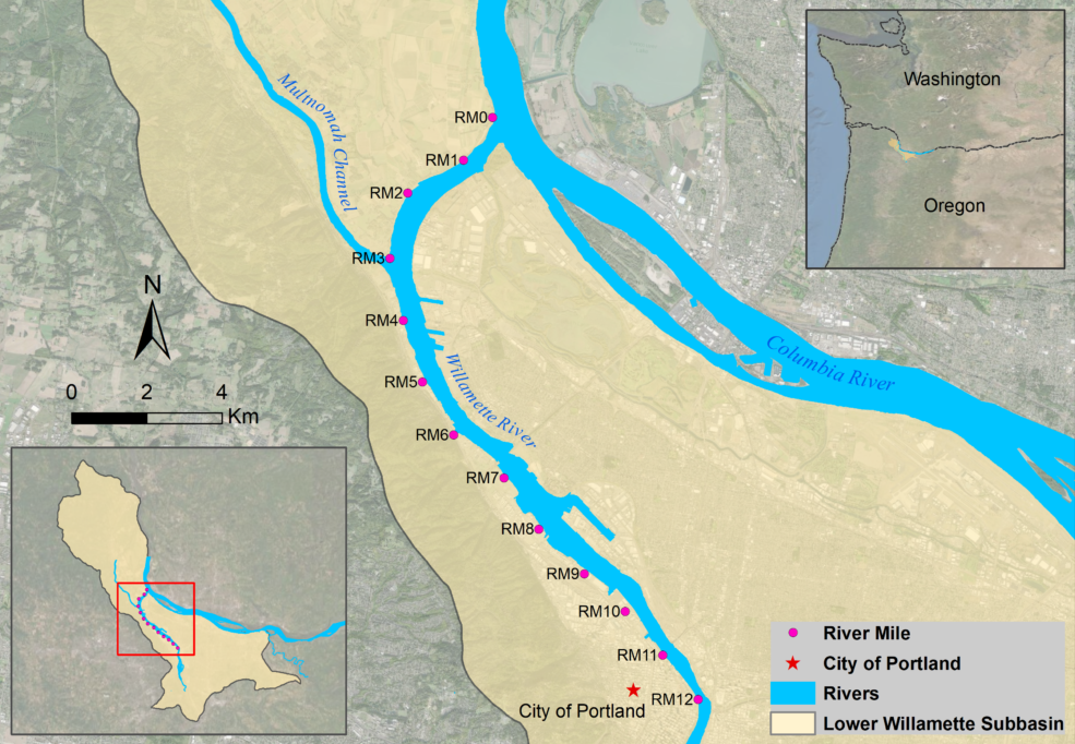
Lower Willamette River and the Portland Harbor Project Area
DSI developed a hydrologic model of City of Portland private and public drainages, loosely coupled with multi-scale hydrodynamic and sediment transport models of the Lower Willamette and Columbia Rivers. The multi-scale hydrodynamic models included a large-scale, coarse grid model for the entire domain and nested, fine grid, high-resolution models for individual sediment management areas (SMAs). This modeling system coupled the simulation of the large-scale hydrodynamic and sediment transport processes of the site with the ability to provide model predictions on the scale of individual SMAs. The system included fully coupled morphologic feedback of hydrodynamics and sediment bed elevation changes between the models to address existing conditions and future mitigation exports.
DSI submitted the final model and the modeling report to the model sponsors to support remedial design, recovery monitoring, and the cleanup cost allocation process.