
Kamman Hydrology and Engineering, California, USA
From 2013 – To 2016
Final report delivered to assist in watershed planning and management

President and Senior Consultant
pmcraig@dsi.llc

Chief Engineer
ntlam@dsi.llc

Hydrologist
bmhoa@dsi.llc
The Novato Creek watershed is the largest watershed in Marin County, California; it drains to San Francisco Bay, and has a drainage area of about 44 sq. mi. Novato Creek flows eastward from relatively steep, predominantly undeveloped, convex hill slopes, across a suburban valley bottom, and through an expansive leveed intertidal bayland to San Pablo Bay. The river is approximately 17 miles long, with elevations ranging from 1900 ft at the ridge to sea level at the Baylands.
As part of the Watershed Restoration Planning and Design study for the Novato Creek Watershed, the Marin County Department of Public Works Watershed Program (MDPW) contracted a modeling study to evaluate feasible alternatives to reduce flood hazards and support sediment management efforts.
The overall project goals involved maintaining and improving the existing level of flood protection, reducing dredging impacts and costs, and improving the efficiency of flood control operations. Other goals included maintaining natural processes, supporting integrated multi-benefit project alternatives, and adapting to climate change.
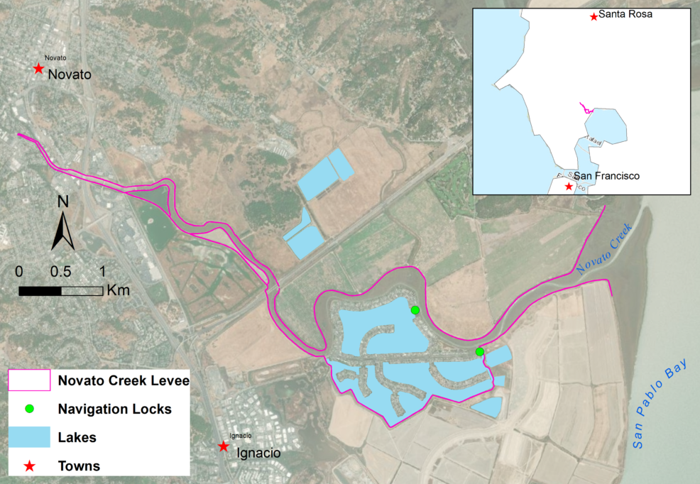
Intertidal Baylands Region of Novato Creek
To support the overall project goal, four numerical models were developed to simulate different sections of the watershed and the feasible alternatives. Using Environmental Fluid Dynamics Code (EFDC), DSI supported the modeling of the Lower Baylands, which are tidally-dominated.
A high-resolution, two-dimensional EFDC tidal Bayland model was constructed to predict flood conveyance and tidal exchange in the intertidal reaches of lower Novato Creek from Diablo Avenue to San Pablo Bay. Inflows from the creek model were passed to the Bayland model at common boundary points. The assessment scenarios were run for Q10, Q50, and Q100 design storm peaks. In addition, a sea-level rise of 16 inches was analyzed for spring tide water levels in the San Pablo Bay.
The final modeling report was submitted to the client to assist in watershed planning and management.Simulating Climate Change Impacts on Novato Creek