
Suncor Calgary, Alberta, Canada
From 2018 – To 2020
Model and report submitted in 2020

President and Senior Consultant
pmcraig@dsi.llc

Operations Manager
tmathis@dsi.llc
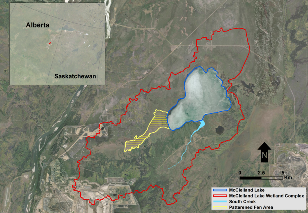
McClelland Lake Wetland Complex (MLWC) is a unique ecosystem located north of Fort McMurray in Alberta, Canada. The watershed covers an area of approximately 204 km2; it is generally flat, with elevations ranging from 288 to 356 m above mean sea level over the entire watershed, and is surrounded by forested uplands. The MLWC includes patterned and unpatterned fen (a specific type of peat-accumulating wetland), swamp, and bog. These elements of the complex support many different kinds of flora and fauna and are important to local aboriginal peoples and recreational users. Higher elevations (primarily in the southwestern part of the MLWC) slope northeastward down to a surface water discharge point on the eastern edge of the watershed.
The overall objective of this study was to evaluate the potential effectiveness of mitigation strategies related to a proposed mine, and assess their feasibility for the conservation of the undisturbed portion of the MLWC. To meet this objective, the factors contributing to the natural variability in water quality observed in the MLWC and McClelland Lake must be assessed in the context of a computational model for surface water quality dynamics. This modeling effort ties into the proposed mine operating plan by examining specific periods of mining operation and closure. Impacts to the overall water quality of the MLWC and McCelland Lake were evaluated for different proposed mitigation strategies.
McClelland Lake in Alberta, Canada
EFDC+ was used to accurately simulate surface water processes, including vegetation and spring freshets. Several major innovations were implemented in this study, including (1) building and simulating nested grids for multiple scales of simulation in a single model, (2) building linkages between EFDC+ and HydroGeoSphere (HGS) model for boundary flow inputs (HGS is an integrated, finite element model groundwater model), (3) extending the EFDC+ domain to uplands areas with ice cover and snowfall.
DSI submitted the final model and report to the client in 2020.