
Alberta Environment Water, Canada
From 2018 – To 2019
Model, reports, and training developed for use as a comprehensive water quality management tool.

President and Senior Consultant
pmcraig@dsi.llc

Chief Engineer
ntlam@dsi.llc

Hydrologist
bmhoa@dsi.llc
The lower reaches of the Athabasca River in Alberta, Canada, are situated between Fort McMurray and Lake Athabasca, where the river is joined by the Clearwater River and several smaller tributaries. These rivers pass through natural oil sand formations where bitumen is found very close to the earth’s surface and are likely to be affected by natural erosional and development processes. The Lower Athabasca River (LAR) has complex geometry; it contains many vegetated islands and alternating sand bars, and is characterized as something between a meandering and a braided river.
As part of an effort to assess the cumulative effects of natural and anthropogenic activities in the Lower Athabasca River (LAR) Basin, the Environmental Monitoring and Science Division (EMSD) of Alberta Environment and Parks (AEP) proposed to develop a predictive integrated modeling system for the area. The hydrodynamic and water quality model of the Lower Athabasca River is a major component of this system. DSI had supported the earlier phases of the LAR modeling project.
The project goal was to develop a comprehensive planning tool to manage water quality in the LAR that would cover the main channel and 10-year floodplain of the Athabasca River from upstream of Fort McMurray to the area near Old Fort.
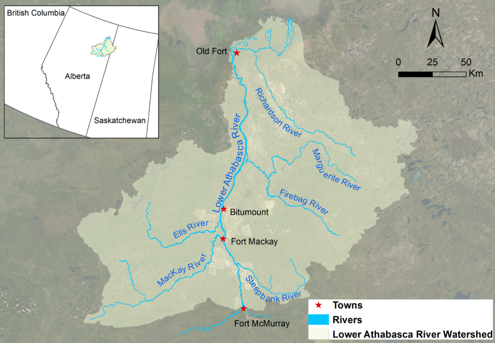
Lower Athabasca River Watershed
DSI developed a two-dimensional, vertically averaged, hydrodynamic and water quality model for the LAR that included all major tributaries and point source effluents. The model was set up to simulate in-stream hydrodynamic processes, sediment transport, water quality, bed sediment quality, and toxic contaminant fate and transport (lead, naphthalene, and phenanthrene) in both the water column and the river bed.
The model was successfully calibrated and validated over a multi-year period (2000-2016). The calibrated model was then used to simulate several scenarios of water management in the Lower Athabasca River to demonstrate the model’s abilities. Scenarios simulated included: (1) water quality improvement of Wastewater Treatment Plan (WWTP) effluent; and (2) a habitat analysis for Walleye fish species, using water temperature as a criterion. The model can be used as a tool for analysis of future development impacts on the water quality in the main stem of the LAR.
DSI delivered the final model and report to AEP, and provided training to the agency on how to simulate management scenarios.